GRANDFATHER RANGER DISTRICT
(IMAGE SOURCE: GOOGLE)
This is in continuation to the previous blog titled "Summer time Recreation in NC". This blog will mainly focus on the "Grandfather Mountain District" in the Pisgah National Fores and what it has to offer for the visitors.
History:
The mountains in the Pisgah National Forest have a lot of history and it is stored in the rocks. In fact, it is estimated that mountain-building started in this area of the world 1.1 Billion years ago! The mountains we see today are the end product of two factors: a). Mountain-building that culminated 300 million years ago and b). the erosion that started 100 million years ago and continues till today.
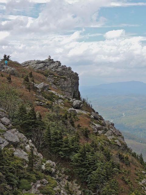
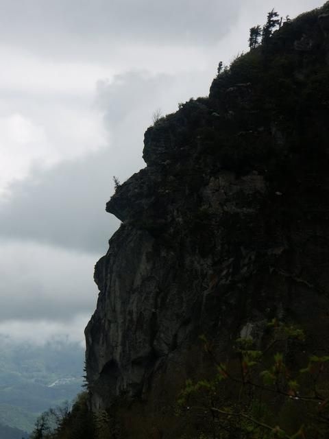
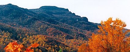
The original name given by the Cherokee Native Americans was "Tanawha" meaning " Fabulous hawk or eagle". When the first pioneers came to this region they recognize an old man's face in one of the elevated rock formations on the mountain, and started calling it "Grandfather Mountain". Because different view/vantage points offer different faces, there is no official picture for the mountain. Although, all the face do resemble an old man check out these pics below:
(IMAGE SOURCE: GOOGLE)
(IMAGE SOURCE: GOOGLE)
---Early Pioneers:
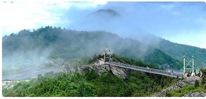
Early pioneers to the area included Daniel Boon, known for hunting these lands in the 1760s. French Botonist Andre Michaux who climbed the Grandfather Mountain in August 1794, and wrote in his journals that he has climbed the highest peak in the continent. Unfortunately, Michaux was wrong, because even though Grandfather mountain peaks at 5,946 feet it is not the highest point even in the Carolinas ! Grandfather Mountain looks high due to the abrupt way it rises above its surroundings.
(IMAGE SOURCE: GOOGLE) (IMAGE SOURCE: GOOGLE)
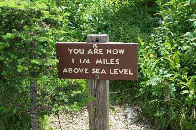
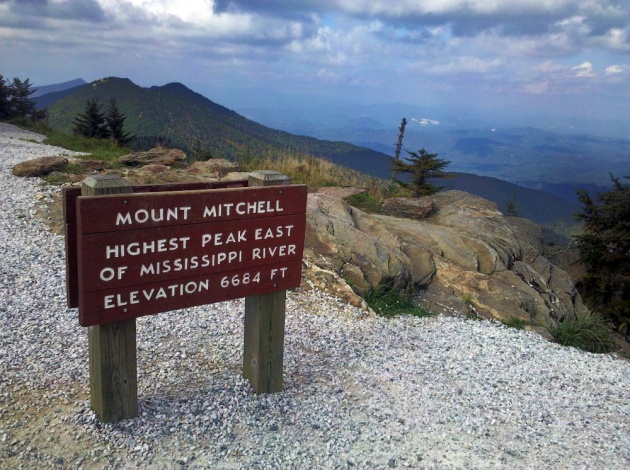
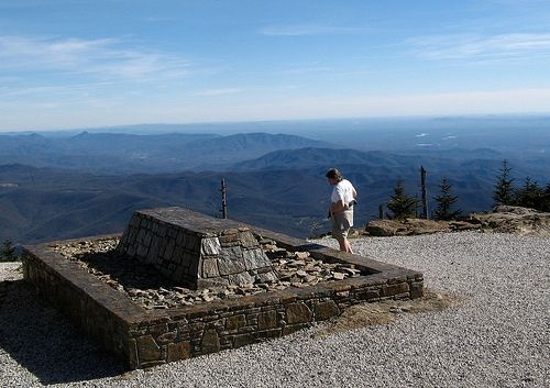
The award for the highest peak in the Eastern America goes to Mount Mitchel, located about 40 miles south in the Black Mountains range and its elevation is 6,684 feet. At the Mount Mitchel State Park there is a sign reading " Your are now 1 1/4 mile above sea level".
(IMAGE SOURCE: GOOGLE)
(IMAGES SOURCE: GOOGLE)
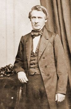
Another notable personality to grace the Grandfather mountain with their presence is Asa Gray, a Harvard Botanist, who came to the Grandfather mountain in 1841 in search of "Shortia Galacifolia" which has been lost since the time of Mithcaux's visit. Unfortunately, Asa Gray was unable to find "Shortia Galacifolia", his efforts did not go in vain because he found another plant known as a lilly and it bears Asa's name to this day as Gray's lilly.
(IMAGE SOURCE: GOOGLE)
-
What is Grandfather Rangers District?
As previously explained, the Pisgah Forest is a vast area in the moutains of North Carolina. The are is so huge is encompasses 15 counties!! so it is divided in three districts (i.e. Grandfather District, Appalachian District and Pisgah District). The Public lands along the Blue Ridge Escrapment northwest of the Black Mountains make up the "Grandfather Ranger District".
-
HIGHLIGHTS OF GRANDFATHER RANGER DISTRICT:
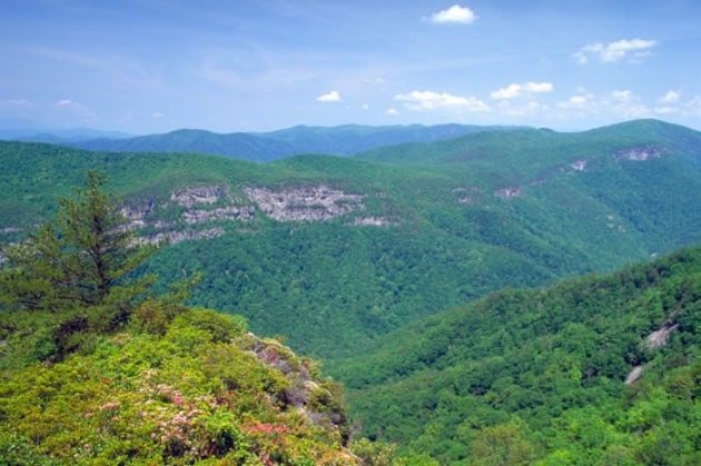
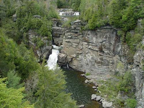
---Linville Gorge: Known as the grand canyon of the east, its an amazing area featuring trails that off a stunning view of the linville river. The river itself is enclosed between the rugged cliffs of the Linville Gorge for up to 12 miles! The area has many varieties of plants and animals, some of the plants found here are Sand mrtyle, red chokeberry, azalea, turkey beard, bristly etc. Animals include deer, bear, squirrel, raccoon, grouse, turkey, vultures, owls, hawks, as well as brown and rainbow trout. Because of the thick vegetation and the rugged landscape Hikers are cautioned against copperheads and timber rattler snakes found in the area. Camping and fishing are permitted but do require a permit, visitors are recommended to stop by the Visitors Center for details, maps and to give a heads up to the Rangers in case a hiker has to be reached for an emergency
(IMAGEs SOURCE: GOOGLE)
Accessability and Parking: The Linville Gorge is easily accessible either from Kristler memorial hwy to N.C. 126 and also from Hwy 221 via N.C. 183. Parking is also not a problem, there are three parking areas. The first parking is for Devil's Hole trail, the second parking is for Hawksbill Traill and the third parking is for Spence Ridge Trail and North Table Rock Trail.
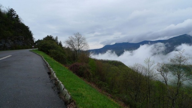
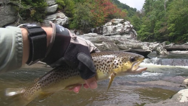
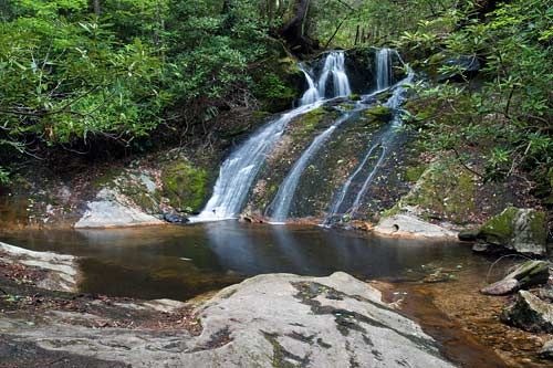
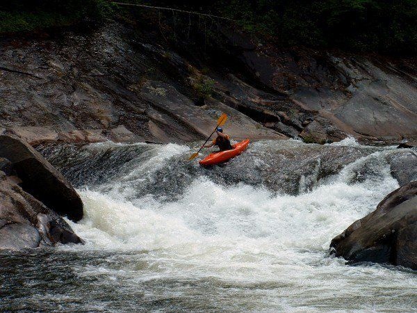
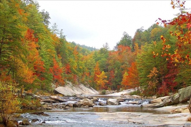
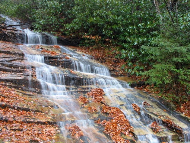
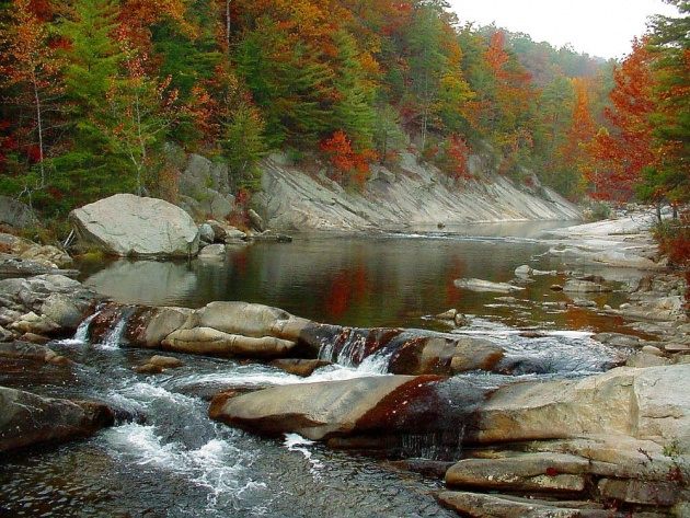
---Wilson Creek Area: This are is a National Wild and Scenic River. This narrow, deep stream valley has a total of 75 miles of back country Trails, meaning the trails are marked at the head only, but otherwise unmarked. Many of the Trails follow streams and have cascading waterfalls, the area is also popular with trout fishing and kayaking. Below are a few pictures of Wilson Creek at different times of the year.
(IMAGE SOURCE: GOOGLE)
(IMAGE SOURCE: GOOGLE)
(IMAGE SOURCE: GOOGLE)
(IMAGE SOURCE: GOOGLE)
---Brown Mountain Area: This area has about 33.5 miles of Trails for Dirt bikes and ATVs. But the most unique aspect of this area is the Mysterious "Brown Mountain Lights", and they have been seen here for hundreds perhaps even thousands of years. The Native Americans of the area knew of these lights before the White men came. These lights are often seen during dry weathers and quite a few people have spotted them from different vantage points. And according to my research the best ones are Wiseman's view on the Linville Gorge, Grandfather mountain and the parking turnout by MP 20 on Hwy 181. The lights change color and move about the side of the mountain are often circular in shape and red to green in color, their source, origin is still a mystery.
Thank you for reading my article, hope you enjoyed it