My driver and I drove by the Line of Control as we passed through an area opposite to the Keran sector of Indian-held Kashmir. From the Chella Bandi Bridge – just north of Azaad Kashmir’s capital Muzaffarabad – to Tau Butt, a valley stretches out for 240 kilometres; it is known as the Neelum Valley (literally, the Blue Gem Valley).
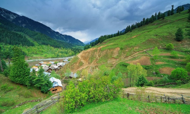
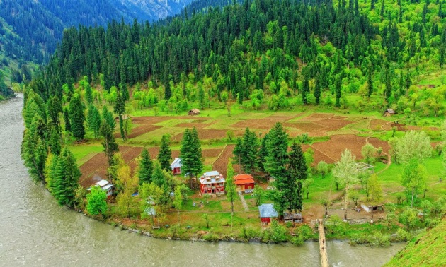
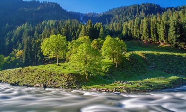
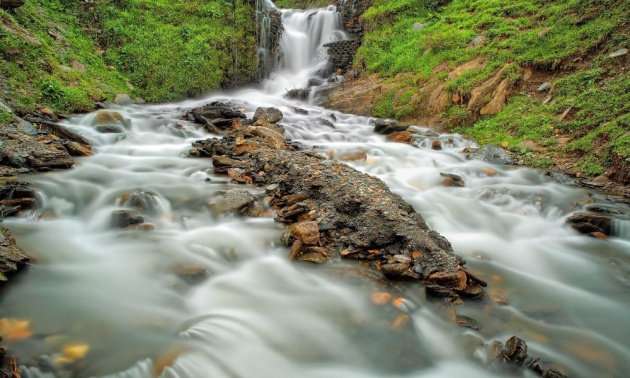
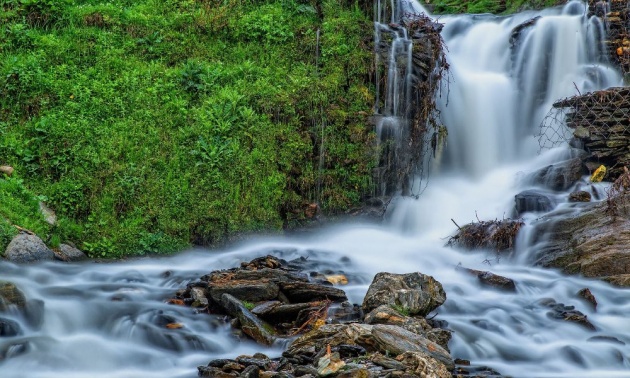
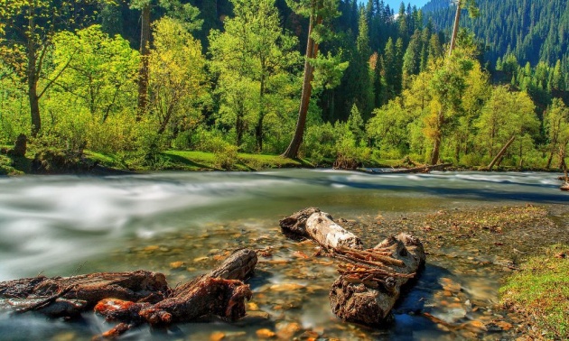
Neelum is one of the most beautiful valleys of Azaad Kashmir, and it hosts several brooks, freshwater streams, forests, lush green mountains, and a river. Here, you see cataracts falling down the mountains; their milky-white waters flowing over the roads and splashing against the rocks, before commingling with the muddy waters of River Neelum.
Athmuqam is the capital city of Neelum Valley. It has been administratively divided into two sub-districts: Athmuqam and Sharda. From Muzaffarabad, a tarred road comfortably leads you to Sharda, whence you need to travel on a rocky and curvy jeep track, which can take you to the farthest town of the region, Tau Butt.
Before Partition, this region was known as Drawah. The Azaad Kashmir government, in 1956, the ninth year of its rule, held a cabinet meeting to rechristen the River Kishanganga as the River Neelum, and the Drawah region as Neelum Valley.
The new names were proposed to the cabinet by war hero, Syed Mohammad Amin. The cabinet approved them, and thus, Drawah of the yore is now Neelum Valley of Azaad Kashmir.
When the far-flung Kashmiri villages located at the feet of the Himalayas beckoned me, I bade adieu to my job and my city before packing up for Kashmir, where lush green mountains were ready to take me in.
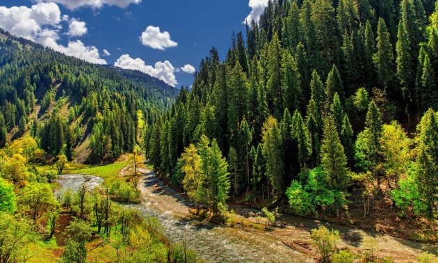
After we arrived in Jhelum district, I stopped on the bridge to look down into the River Jhelum. The muddy water flowed down slowly. I was going to meet the same river upstream, where it enters into Pakistan from Azaad Kashmir (and changes its name from Neelum to Jhelum). The river seemed too sluggish in the plains of the Punjab, but I knew that up in the mountains, it is furious and noisy, with green waters winding through narrow mountain passes.
Jhelum, aka Neelum, aka Kishangana. Just then the song playing in the car switched to:
♪ Kis naam say pukaron, kia naam hay tumhara ♫
(What shall I call you, what is your name)
Cities, town and villages went by one after the other; Rawalpindi was gone; then from Murree, the car darted towards Muzaffarabad. The road from Kohala to Muzaffarabad was narrow but tree-lined; the car travelled under the shadows of the trees. The surrounding mountains had worn the newly-sprouted bright-coloured grass.
There was greenery everywhere, punctuated with pomegranate trees that lined up the road and proudly held out their red petals. Against their green backdrop, the red petals seemed almost seductive. I thought of stealing them from the pomegranate trees, but the very next moment, Jon Elia intruded my subconscious, saying, “dekh lo phool, phool torro mat” (Look at the flowers, don’t snip off the flowers).
The pomegranate petals continued to dance along the road until we reached Muzaffarabad – a densely populated city, with houses literally sitting on the roofs of other houses.
After crossing over the River Neelum Bridge, I had to leave the car and hire a jeep, which was to take me to my destination, the Neelum Valley.
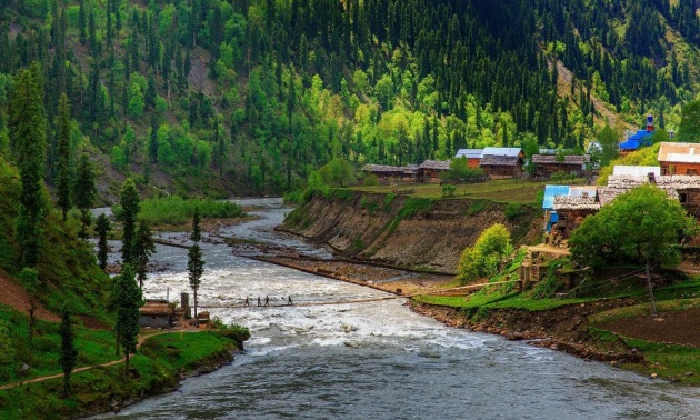
As I was being driven along the River Neelum, I was amused to notice how contentedly this river flowed, serving as natural border between Pakistan and India, oblivious to their animosity.
Pakistan is building the Neelum-Jhelum hydropower dam on the River Neelum. It was summertime, but the project still appeared to be frozen. The jeep entered Athmuqam and moved through its crowded streets before emerging on the other side that faced Keran. At the other end of the bridge that spanned over the River Neelum, was Indian-held Kashmir.
Travelling along the Line of Control, I felt that although the two Kashmirs had been divided by a border, they held many things in common: on the both sides of this divide, jeeps and buses play the same music; culture and cuisine is the same; the population on both sides belongs to the same ethnicity, draws water from the same river, and lives under the same clouds; the difference is seen only on the masts that hoists the national flags – the flags are different, so are the governments and perhaps the hearts, too.
The driver notched up the music volume and the song that rolled off the cassette player now said:
♪ Gham-e-dil ko en ankhon se chalak jana bhi aata hai ♫
(The grief is wont to roll down from these eyes)
We arrived in the village of Dowarian. From this point on, a trail leads to the Ratti Gali Lake. Nature probably worked long and hard to create Ratti Gali, first carpeting it with green velvet grass, and then speckling it with yellow, blue, and orange shades.
The blue waters and scenic beauty of this lake gravitate tourists with such a pull that they would battle mountains, rivers, and the hardships of trekking to arrive at this spot. A sight of Ratti Gali Lake is worth all the trouble.
The jeep continued to move along. At a little distance from the turn to Ratti Gali, a road branches out and treks up the mountain to meet the village of Upper Neelum. Perhaps, the entire valley takes its name from this village.
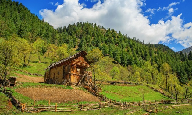
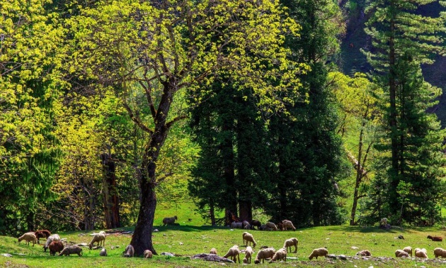
The jeep arrived in Sharda and stopped at its main marketplace. My eyes strayed to a few donkeys standing on the rooftops of houses and shops and grazing wild grass that had sprung up there. Seeing donkeys on rooftops particularly struck me as quite hilarious.
In Sharda, houses are built on the steep mountain slopes in a way that their roofs are partly stuck into the mountain. It allows animals to easily walk onto the rooftops. The donkeys were perhaps attracted by the sweet smell of the grass here.