Calbuco Volcano
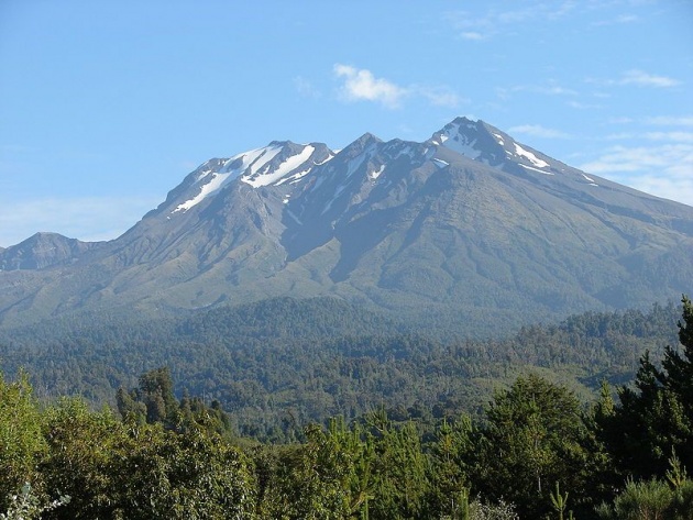
Photo by: Jason Quinn
Calbuco Volcano (Volcán Calbuco) as seen from the north from the shores of Llanquihue Lake (Lago Llanquthue) from Road 225.
Calbuco (kahl-boo-koh; Spanish: Volcán Calbuco, is a stratovolcano located southeast of Llanquihue Lake and northwest of Chapo Lake, in the Los Lagos Region, and close to the cities of Puerto Varas and Puerto Montt in southern Chile. With an elevation of 2,105 meters above sea level, the volcano and the surrounding area are protected within the Llanquihue National Reserve.
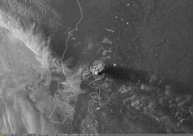
The most recent eruption happened on April 22, 2015, followed by two smaller eruptions on April 24 and April 30. This was Calbuco's first activity since 1972.
Calbuco is located partly in Puerto Varas Commune and partly in Puerto Montt Commune. It lies 49 km from the city of Puerto Varas and 69 km from Puerto Montt. Its name is thought to come from the Mapuche words "kallfü" (blue) and "ko" (water), meaning "blue water". It shares the name with Calbuco Island in nearby Reloncaví Sound as well as the city and commune of Calbuco, although it is not located there.
Calbuco is located partly in Puerto Varas Commune and partly in Puerto Montt Commune. It lies 49 km from the city of Puerto Varas and 69 km from Puerto Montt. Its name is thought to come from the Mapuche words "kallfü" (blue) and "ko" (water), meaning "blue water". It shares the name with Calbuco Island in nearby Reloncaví Sound as well as the city and commune of Calbuco, although it is not located there.
Calbuco is a very explosive andesite volcano whose lavas usually contain 55 to 60% silicon dioxide (SiO2). It is elongated in a SW-NE direction and is capped by a 400-500 meter wide summit crater. Its complex evolution included the collapse of an intermediate edifice during the late Pleistocene that produced a debris avalanche that reached Llanquihue Lake.
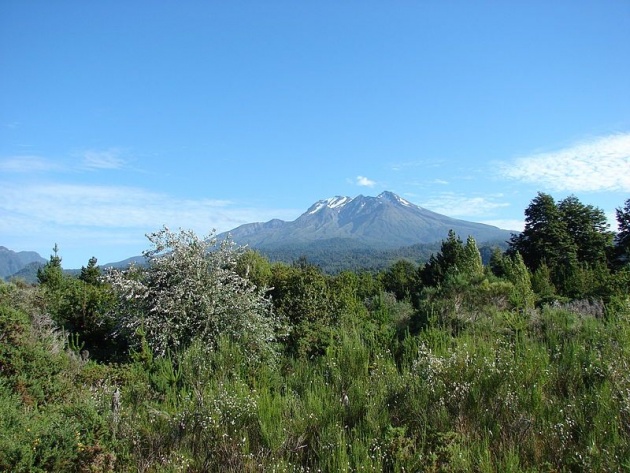
photo credit: Jason Quinn
Calbuco has had 36 confirmed eruptions in its history, with 13 eruptions recorded since 1893. 20th century eruptions took place in 1906, 1907, 1909, 1911, 1917, 1929, 1932, 1945, 1961, 1972 and 1996. A series of three eruptions occurred from April 22–30, 2015.
The 1893-4 Calbuco eruption was one of the largest ever to take place in southern Chile, with debris ejected to distances of eight kilometres, accompanied by voluminous hot lahars. In the strong explosions of April 1917, a lava dome formed in the crater accompanied by hot lahars. Another short explosive eruption in January 1929 also included an apparent pyroclastic flow and a lava flow.
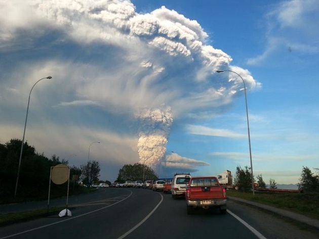
photo credit: Aeveraal
Eruption of Calbuco seen from the city Puerto Varas.
The major eruption of 1961 sent ash columns 12–15 km high, produced plumes that dispersed mainly to the south east and emitted two lava flows. There was a minor, four-hour eruption on August 26, 1972. Strong fumarolic emission from the main crater was observed on August 12, 1996.
2015 eruption
Calbuco erupted on April 22, 2015, for the first time in four decades. The eruption lasted 90 minutes and sent a plume of volcanic ash 10 km into the sky. A flow of lava was reported into Chapo Lake on the same day. The eruption caused airline flight cancellations to Chile as well as Argentina and Uruguay. Authorities evacuated 4,000 people from a zone with a 20 km radius from the volcano.
Further eruptions took place on April 24 and April 30, 2015. Experts have warned about the possibility of acid rain and lahars. On May 5, 2015, the Chilean government reported that tourist activity in the area had returned to "routine" levels.
(source: Wikipedia)