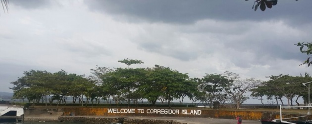
Corregidor Island
Corregidor Island is an island was set by the Spaniards as a dockyard in 1795 then followed by a naval hospital. The island is the largest of the islands that formed the harbor defenses of the Philippines and the Americans against the Japanese, together with El Fraile Island(Fort drum), Caballo Island(Fort Hughes) and Carabao Island(Fort Frank), during the World War II.
Now, the island is one of the most historic and tourist site of the country.
https://www.youtube.com/watch?v=Y0EYbJJhhKk
**Video credited to Jimmy Kruis
How to get to the Island?
Corregidor Island is part of Cavite(Southern Luzon), Philippines, but getting there can be either from Mariveles, Bataan(Central Luzon) or from Cavite, by boat and ferry respectively. For us, we get reached the island by taking a boat from Mariveles port.
The boat ride took us more than 30 minutes to an hour since the weather was pretty bad that time.
*Note:Check the weather before going there*
By the way, we took the travel package that includes the boat fare and the tour and tourist guide and including the Malinta Tunnel experience.
*Note: The price we paid all in all was Php1,200--Php 1,000 for the boat and Php for the Malinta Tunnel Experience.

The Port where we get our boat.
The Island
What are the things to see in the Island?
The Island has FOUR SECTORS:
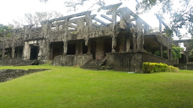
- The Topside. This sector is said to be the largest and the nerve center of the island's fortress. The place where you can see the Mile-Long Barracks; Pacific War Memorial; Eternal Flame of Freedom; Spanish Flagpole; Cine Corregidor and the Spanish Lighthouse.

The Eternal Flame of Freedom
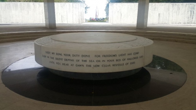
The altar below the Pacific War Memorial
2. Middleside. What to see on this sector are the Filipino-American Friendship Park; Middleside Barracks; Aviary and Theme Park; Army Hospital and the YMCA yout for peace campsite.
3. The Bottomside. This is the sector where you can see docks like, South Docks where yatchs and ferry boats dock; Lorcha Dock where Gen. Douglas McArthur boarded; North Dock, the service dock of the island. The Bottomside is where you also see the Barrio San Jose and its Chapel; Administration Building, Gen. Douglas McArthur Park and Gen. Jonathan M. Wainright Memorial.
4. The Tailend. The sector where you can see other memorials, shrines and the island's airstrip is located.
What else to see on the island?
Malinta Tunnel. In the east of the bottomside hill is where you can see and get in to the Malinta Tunnel. The tunnel is said to be built/made to facilitate passage and to be a bombproof shelter. The Tunnel was built for 10 years. It has 835 feet long east-west passage(main tunnel), 24 feet wide and height of 18 feet. It has 13 lateral tunnels on the north and 11 on the south side, each lateral has an average of 160 feet in length and 15 in width.
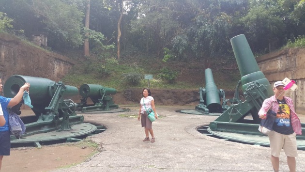
Gun Emplacements. There are 23 batteries that were being set up on the island and its adjoining island when the World War II broke in 1941. These consisted of 56 coastal guns and mortars.
The Battery Way
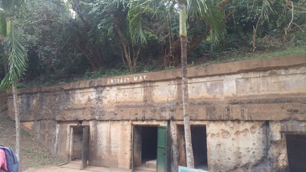
Battery way.
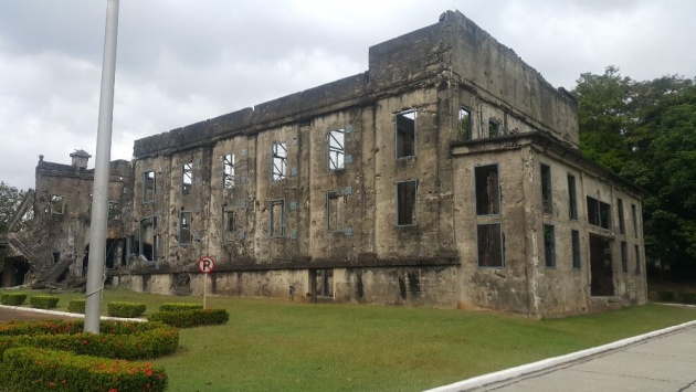
The island is indeed filled with history and ruins and here are some of the ruins that I took a picture of. Proofs that my country, Philippines is rich with history and beauty.


Hope you get the chance to visit the island too.
*Note:Images used are mine.